Waihee Ridge Trail
Waihee Ridge Trail
6.4 km ridge hike above Waihee Valley on Maui: three viewpoints, Makamaka'ole waterfall and panoramic views of neighboring islands.
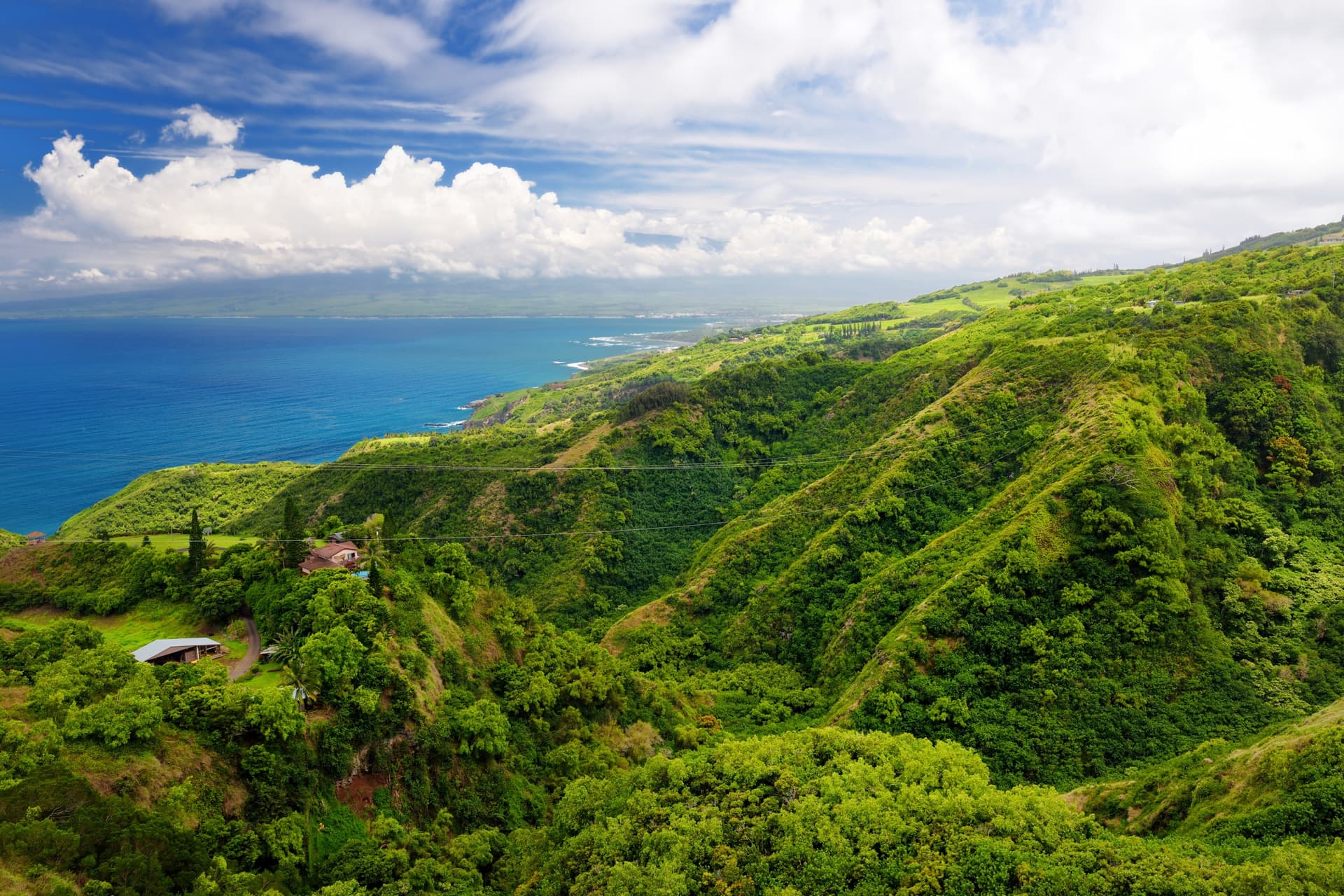
The Waihee Ridge Trail ranks among Maui's most cherished ridge hikes. Over 6.4 km round-trip, the trail climbs above Waihee Valley to the summit of Lanilili, offering views of the north shore, the Makamaka'ole waterfalls and, on clear days, the neighboring islands.
Why hike the Waihee Ridge Trail
The trail combines several rare assets on a single hike: continuous but manageable elevation gain, dense tropical forest, three distinct viewpoints and a panoramic 360-degree summit. The ridge separates two slopes of Maui and allows you to take in both the Pacific Ocean and the island's mountainous interior. Between December and April, humpback whales are regularly spotted from the heights.
History and culture of the site
Waihee is an ancient Hawaiian village that was, at its height, one of Maui's religious and political centers. The royal temple of Kahekili, the last independent king of Maui in the 18th century, once stood in this valley. The inhabitants had developed an elaborate system of irrigation canals to cultivate taro, a sacred root transformed into poi, the traditional foundation of Hawaiian cuisine.
The trail's surroundings still bear traces of this ancient settlement: petroglyphs, agricultural terraces and dry stone walls still testify to how the land was organized before European contact.
Trail overview
The hike begins with a steep concrete ramp that serves as a warm-up and sets the tone for the outing. After fifteen minutes of climbing, the first viewpoint opens onto the Makamaka'ole waterfall, which cascades down the opposite cliff face in several tiers. A bench allows for a first rest.
The trail then crosses humid forest where ferns, bamboo, wild orchids and breadfruit trees intermingle. The Northern Cardinal and Japanese White-eye, species introduced but now common in Hawaii, accompany your progress. The path, well-marked, is often muddy and slippery: shoes with good traction are essential.
After roughly 45 minutes, the second viewpoint overlooks Waihee Valley, with the river below and Kahului Bay on the horizon, where you can make out the harbor and town. On clear days, Haleakala stands out to the south and Mauna Kea, on the island of Hawaii, may appear in the distance.
The Kanoa ridge takes over next, taking you from one slope to the other. The islands of Molokai, Lanai and Kahoolawe are silhouetted above the ocean. The third and final viewpoint, at the summit of Lanilili (approximately 760 m in elevation), welcomes a picnic area and a logbook for hikers.
The return is usually made via the same route. An alternative loop exists via the Makamaka'ole trail, longer and wetter, which descends the valley's wild slopes.
Practical information
- Distance: 6.4 km round-trip
- Duration: 3 to 4 hours depending on pace
- Level: moderate to difficult, continuous elevation gain
- Equipment: hiking shoes with good grip, plenty of water, sun protection, lightweight windbreaker
- Safety: avoid the trail after heavy rains (significant mud, reduced visibility on the ridge)
An early morning start is recommended: clouds often settle on the ridge mid-morning and obscure the panoramic views.
When to go
The trail is passable year-round. The climate of northern Maui is influenced by northeasterly trade winds, which bring regular rainfall, more pronounced between November and March. Spring (March-May) and fall (September-November) offer the most stable conditions. Humpback whale watching season runs from December to April, a period when rain is more frequent but when ocean views are well rewarded.
How to get there
The trailhead is located on Maui's north shore. From Wailuku or Kahului, follow Highway 340 beyond the village of Waihee. Look for the sign indicating Camp Maluhia BSA and turn onto Maluhia Road, which climbs into the forest for approximately 3 km to the gravel parking lot. Parking is free but limited; arriving early helps avoid having to park further down the road.
Nearby attractions
Maui and the Hawaiian archipelago offer other hikes and natural sites that complement the Waihee Ridge Trail. On the neighboring island of Oahu, the Manoa Falls offer a shorter walk through tropical forest. For other American parks with contrasting profiles, Crater Lake National Park in Oregon is worth the detour.
Frequently asked questions
Frequently asked questions
Planning your trip
The Waihee Ridge Trail naturally fits into an itinerary on Maui combining hikes, north shore beaches and the Road to Hana. To build a customized trip including this hike, consult our United States trips.
Interested in this visit?
We can include it in your personalised itinerary.