Shell Canyon
Shell Canyon
Shell Canyon cuts through Wyoming's Bighorn Mountains along U.S. Highway 14: waterfalls, ancient rock formations, and a Native American sacred site.
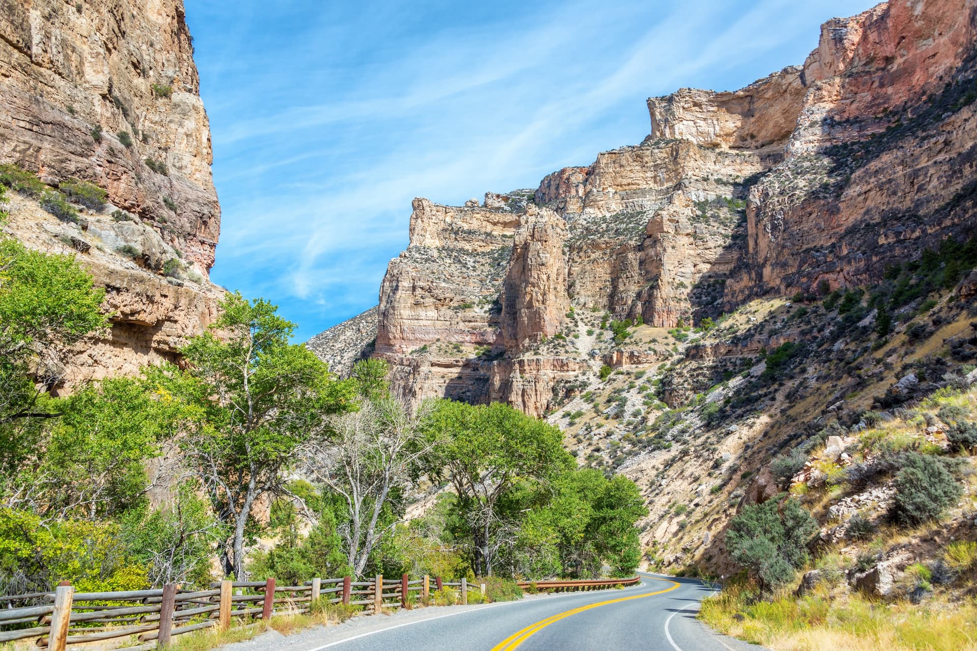
Shell Canyon carves through the western flank of the Bighorn Mountains in northern Wyoming. Sculpted by Shell Creek, it stretches along U.S. Highway 14, between the Bighorn Basin plains and the forested high plateaus. Waterfalls, ancient rock walls, and Native American heritage make it a natural stop on the route between Yellowstone and Mount Rushmore.
Why Visit Shell Canyon
The canyon offers a snapshot of interior Wyoming: spectacular geology, Rocky Mountain wildlife, and Indigenous heritage. The rocks exposed in the canyon walls rank among the oldest in the United States, with some dating back more than 2.5 billion years. The site remains relatively uncrowded, making it a worthwhile complement to neighboring major parks. Your visit combines quick scenic stops with more engaging excursions into the heights of the Bighorn.
What to See and Do
Shell Falls
The canyon's main waterfall cascades down a rock face approximately 120 feet high. A short, accessible trail leads to an observation platform, complemented by an interpretation center showcasing local geology and wildlife. Water flow is most impressive in spring during snowmelt.
Devil's Kitchen
A few kilometers away, this geological site features aligned stone towers, colorful badlands, and formations carved by erosion. The terrain invites short hiking distances on foot. It pairs nicely with a visit to the falls for those interested in rock formations.
Bighorn Medicine Wheel
Perched at over 9,500 feet atop Medicine Mountain, this circular stone structure is a sacred Native American site. Estimates place its origin at over 700 years ago. It served ceremonial and ritual purposes and continues to be used today by several nations. Access is on foot from a parking area along a trail spanning several kilometers, requiring respectful conduct: no drones, no objects placed on the wheel.
Antelope Butte
This small mountain resort operates as a ski area in winter, with runs for all ability levels, and transitions to hiking and mountain biking in summer. It serves as a solid base for exploring the forested heights of the Bighorn.
Paint Rock Canyon
On the south slope, Paint Rock Canyon shelters petroglyphs attributed to Indigenous peoples of the region. The canyon crosses partly through private lands: check locally before attempting entry.
Shell Creek and the Scenic Byway
Shell Creek, which carved the canyon, is renowned for fly fishing, particularly for trout. U.S. Highway 14 itself, designated the Bighorn Scenic Byway, features multiple developed overlooks along its switchbacks between the plain and the pass.
Wildlife to Observe
- Mule deer and elk, especially along forest edges at dawn and dusk
- Black bears, present in the Bighorn: bring bear spray on hikes and store food properly
- Small raptors and marmots on rocky areas
Practical Information
- The Shell Falls interpretation site opens seasonally, typically May through September, depending on weather conditions
- U.S. Highway 14 remains open year-round but can be affected by snow and ice outside the summer season
- No entrance fee for the canyon; a modest access fee applies to Bighorn Medicine Wheel via the National Forest
- Bring water, layered warm clothing, and hiking boots: elevation quickly exceeds 8,200 feet at higher elevations
- Cell service is very limited in the canyon
When to Visit
From late May through mid-September, all sites are accessible, including the trail to the Medicine Wheel, which opens only after snowmelt. June offers the most powerful waterfalls. July and August are the most stable months for high-altitude hiking. Autumn, quieter and colorful with aspen foliage, is also appealing. In winter, only Antelope Butte truly operates for skiing.
How to Get There
Shell Canyon is located on U.S. Highway 14, also called the Bighorn Scenic Byway, which connects Sheridan to the east and Greybull to the west through the Bighorn Mountains. From Greybull, count about twelve miles east to the village of Shell, where the canyon begins. The nearest regional airports are Cody, Sheridan, and Billings (Montana). A car is essential: there is no public transportation.
Combine with Nearby Attractions
The canyon fits naturally into a broader itinerary across the American West. To explore more spectacular landscapes and wide-open spaces, several stops can enrich your journey:
- Crater Lake National Park, another major geological site in the West
- Cave of the Winds, to explore an underground realm in neighboring Colorado
- Cadillac Ranch, an iconic stop on Route 66
- Manoa Falls in Hawaii, for a different waterfall experience
Frequently asked questions
In northern Wyoming, Big Horn County, east of the village of Shell, along U.S. Highway 14 as it crosses the Bighorn Mountains.
Allow 1 to 2 hours for a stop at Shell Falls and the interpretation center. Half a day to a full day if you add Devil's Kitchen, the Medicine Wheel, and the scenic drive.
The canyon and scenic byway are free to access. A modest National Forest fee applies to Bighorn Medicine Wheel.
U.S. Highway 14 stays open but is subject to snow. The falls interpretation center closes outside season, and the trail to the Medicine Wheel is only passable from late spring to early fall. Antelope Butte operates as a ski resort.
The region is home to black bears. When hiking, stay in groups, make noise, carry bear spray, and store food in appropriate containers.
Plan Your Trip
Shell Canyon fits logically into an itinerary across the American West combining Yellowstone, Grand Teton, and the Black Hills. To build a custom itinerary incorporating this stop, consult our États-Unis vacations.
Interested in this visit?
We can include it in your personalised itinerary.