Koko Crater Railway Trail (Koko Crater Arch Trail)
Koko Crater rises via 1,048 wooden ties of an old military railway. Sustained effort, 360° panorama over Hanauma Bay and Oahu's eastern coast.
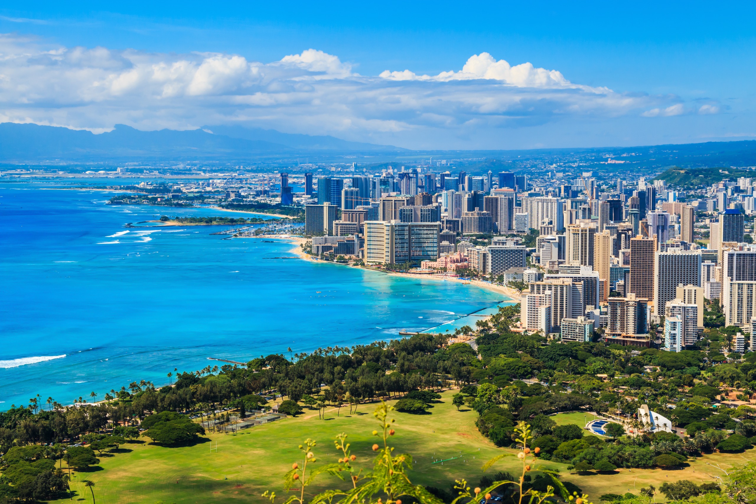
Koko Crater stands to the east of Honolulu, in the Hawaii Kai district. This extinct volcanic crater is climbed via an old military railway: 1,048 wooden ties ascend in a straight line to the summit, at approximately 368 meters elevation. The climb is short but demanding. The reward: a 360° panorama over the Windward coast, Hanauma Bay and the Pacific.
Practical info at a glance
- Access: Free entry, no reservation required.
- Recommended duration: 1.5 to 2 hours round trip depending on pace.
- Difficulty: High — steep slope, uneven ties, some sections nearly vertical.
- Gear: Hiking boots with grip soles strongly recommended; flip-flops are dangerous.
- Water: No water sources on the trail — bring at least 1 liter per person.
- Accessibility: Not wheelchair accessible.
- Animals: Dogs on leash are permitted.
What you'll see
The trail follows the rails and ties of an old military tramway built during World War II to transport equipment to the summit. Halfway up, a suspension bridge spans a ravine and cuts across the trail: some hikers avoid it via a lateral dirt path. At the summit, the crater reveals an interior covered in dry vegetation and, in the distance, the cliffs of Koko Head.
History and context
Koko Crater is a tuff cone volcanic formation created approximately 7,000 to 10,000 years ago during phreatomagmatic eruptions. The United States Army installed a tramway line there during World War II to serve observation stations at the summit. The rails have disappeared; the wooden ties, however, remain and make up the trail today.
Highlights of the hike
The climb on the ties
One thousand forty-eight ties, slopes that sometimes exceed 45°. Your pace will find itself: you'll place your hands on the ties above you in the steepest sections. The effort is real, but progress is tangible — you count the steps.
The suspension bridge
About two-thirds of the way up, the rails cross a ravine on a metal bridge. Crossing requires some balance; a dirt bypass trail exists for those who prefer to avoid it.
The panorama at the summit
From the summit, the view sweeps across Hanauma Bay to the southwest, the Windward coast to the northeast, Makapuu Point and, on clear days, the islands of Molokai and Lanai on the horizon. The interior of the crater, on the west side, reveals a botanical garden managed by the city.
The crater botanical garden
The crater floor is home to the Koko Crater Botanical Garden, accessible via a separate vehicle entrance. It features succulents, cacti and xerophytic species from around the world — a complementary visit possible the same day.
Photo tips
Morning light (before 9 a.m.) is ideal: the sun illuminates the eastern coast without backlighting. At sunset, golden light over Hanauma Bay is remarkable, but descending in the dark on the ties is risky without a headlamp. From the summit, frame toward the southeast to capture both the bay and open ocean.
Location and access
The trailhead is located at Koko Head District Park, in the Hawaii Kai district, east of Honolulu. By car from Waikiki, allow approximately 25 to 30 minutes via the Kalanianaole Highway (H-72). Free parking is available on-site. Public transit (TheBus) serves the area, but frequency is limited — check schedules on the official TheBus website before departing.
In the immediate vicinity: Hanauma Bay (snorkeling, a few minutes by car) and Makapuu Point Lighthouse Trail (more accessible hike, Windward coast).
Nearby attractions
- Hanauma Bay Nature Preserve — Protected marine reserve, one of Oahu's best snorkeling spots; advance online reservation required.
- Makapuu Point Lighthouse Trail — Paved and accessible trail, panoramic views of the Windward coast and whale watching in winter.
- Sandy Beach Park — Beach renowned for bodysurfing, watch from shore if you're not an experienced swimmer.
- Koko Crater Botanical Garden — Garden of xerophytic plants at the crater floor, separate entrance, peaceful visit to complement the hike.
Frequently asked questions
The hike is doable year-round. April to October offer the driest days. Start early in the morning (before 8 a.m.) to avoid heat and crowds, whatever the season.
It suits children comfortable with heights and accustomed to physical exertion, from around 8-10 years old. The uneven ties and suspension bridge require vigilance. Not recommended for very young children.
Hiking boots or trail shoes with grip soles are strongly recommended. Flip-flops and flat sandals are dangerous on wet or damaged ties.
Yes, it's a common pairing. Do the hike early in the morning, then head to Hanauma Bay by car (a few minutes away). Note that Hanauma Bay requires advance online reservation.
Yes, without particular restrictions. The summit offers an unobstructed 360° panorama — plan for storage space on your phone or camera.
Restrooms are available at the Koko Head District Park parking area. There is no water source on the trail itself — bring plenty of water before you start.
Interested in this visit?
We can include it in your personalised itinerary.