Mount St. Helens
Mount St. Helens
Active stratovolcano in southwest Washington, famous for the 1980 eruption. Over 320 km of trails, Ape Cave lava tube and Coldwater Lake on the itinerary.
Mount St. Helens is an active stratovolcano in the southwest of Washington State, in Skamania County. Known for the catastrophic eruption of May 18, 1980, it now offers a rare vantage point for observing the regeneration of a devastated ecosystem, with over 320 km of trails, visible lava domes within the crater, and wildlife resettled in the heart of the Gifford Pinchot National Forest.
Why visit Mount St. Helens
The site combines geological interest, volcanic landscapes and nature in recovery. The north-facing open crater, the blast zone visible for several kilometers, and Coldwater Lake, formed by the 1980 eruption, provide a concrete understanding of volcanic phenomena. The protected area spans 445 km² and allows visitors to alternate between hiking, lava tube exploration, kayaking or wildlife watching.
The volcano sits within the Pacific Ring of Fire, which concentrates most of the planet's active volcanoes. Its position, roughly 85 km north-northeast of Portland and 155 km south of Seattle, makes it an accessible stop from the two major cities of the American Northwest.
History and volcanic activity
The summit was first charted in 1792 by British navigator George Vancouver, aboard HMS Discovery. Its name honors Lord St Helens, a diplomat and friend of Vancouver. Before 1980, Mount St. Helens was the state's fifth-highest peak, with a regular conical silhouette often compared to Mount Fuji.
On May 18, 1980, an earthquake triggers the collapse of the volcano's north face. The pyroclastic flow that follows claims 57 lives and completely reshapes the landscape for dozens of kilometers. Ash fallout reaches several neighboring states. This ash was later transformed into helenite and ceramic enamels by local artisans.
Activity did not cease in 1980. A lava dome reached approximately 250 meters by 1986. Following a series of seismic tremors, a new dome emerged in 2004 and emitted lava until 2008. By 2013, the domes occupy nearly 7% of the crater. Another seismic sequence occurred between 2016 and 2018. On May 14, 2023, a debris flow blocked access to certain areas of the site. The volcano remains under continuous monitoring by the USGS, with a known risk of lahars in the Toutle River should activity resume.
Geologically, the massif combines basalt, andesite, pumice and dacite domes, a classic signature of the stratovolcans in the Cascade Range.
What to see and do
Mount St. Helens National Volcanic Monument
The heart of the site, this national monument protects the 1980 blast zone and offers over 320 km of trails for all levels. Panoramic viewpoints allow observation of the open crater, interior domes, and the slow botanical recovery. Johnston Ridge Observatory, on the north face, is one of the most telling vantage points for understanding the eruption.
Ape Cave
This lava tube, one of the continent's longest, is explored with a headlamp. The temperature remains stable around 5.5 °C year-round, so bring warm clothing and sturdy shoes, even in summer.
Coldwater Lake and Trail of Two Forests
Coldwater Lake appeared after the 1980 eruption, when lava flows dammed a stream's course. It is ideal for kayaking, stand-up paddling and fishing. Further south, the Trail of Two Forests follows a wooden walkway across an ancient lava flow, where you can see tree molds cast by lava, evidence of earlier eruptions.
Summit climb
The summit is accessible but regulated. A permit is required to reach the top (managed by quotas, reserve in advance via Mount St. Helens Institute). The most common route starts from the south, presents no major technical difficulty but demands good physical fitness due to elevation gain and ash terrain.
Marble Mountain and winter activities
In winter, the southern sector welcomes snowshoeing, cross-country skiing, snowmobiling and winter ascents on snow. Marble Mountain Sno-Park serves as a trailhead for several marked routes.
Aerial tours by plane or helicopter
Several operators based around the volcano offer scenic flights. Viewed from above, the gaping crater and blast zone reveal themselves in a single perspective, usefully complementing ground observations.
When to go
The main season runs from late June through mid-October, when high-altitude roads and interpretation centers are fully open. For the summit climb, the most popular window extends from May through October, with snow still present in spring and a permit required year-round. Winter (December to March) closes some access but opens winter sports practice on the south side.
The climate is temperate Mediterranean, with an annual average of 11.7 °C and roughly 931 mm of precipitation, concentrated from fall through spring.
Practical information
- Permit: required for the summit climb, reserve well in advance.
- Visitor centers: Silver Lake Visitor Center at the west entrance, Johnston Ridge Observatory on the north side, Ape's Headquarters on the south side (seasonal openings).
- Fees: a daily entrance fee or annual United States pass is required at most major sites.
- Camping: Seaquest State Park (near the west visitor center), Iron Creek and Cougar on the south side. Reservation recommended in summer.
- Safety: follow USGS bulletins, never venture outside designated areas within the crater or blast zone.
How to get there
The volcano is located roughly 85 km north-northeast of Portland and 155 km south of Seattle, accessible from Interstate 5.
- North face (Johnston Ridge, Coldwater Lake): Exit 49 at Castle Rock, then Highway 504, known as Spirit Lake Memorial Highway.
- South face (Ape Cave, Marble Mountain, Trail of Two Forests): Exit 21 at Woodland, then Highway 503 toward Cougar.
No public transportation serves the site; a personal vehicle or organized tour is essential.
Nearby attractions
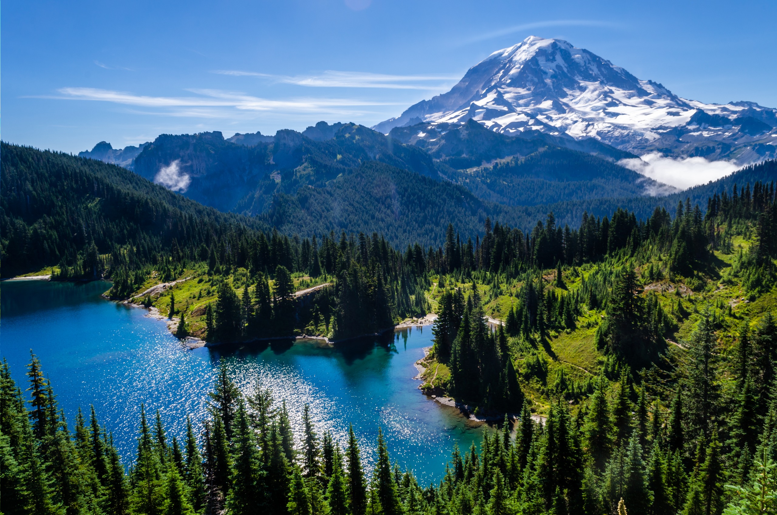
Mount St. Helens fits naturally into an itinerary in the American Northwest. Portland and Seattle serve as logistical bases. Further west, the Pacific coast is reached in roughly two hours, while other Cascade volcanoes, Mount Rainier and Mount Adams, complete a coherent geological circuit. To extend your trip to other United States natural sites, consider Canyonlands National Park or Bryce Canyon National Park in Utah, or the Manoa Falls in Hawaii for tropical contrast.
FAQ
Frequently asked questions
Plan your trip
Mount St. Helens naturally fits into an itinerary through the American Northwest, between Seattle, Portland and the Cascade Range. To build a custom itinerary including this site and other national parks, explore our United States trips.
Interested in this visit?
We can include it in your personalised itinerary.